Matana
Matana is a Burundian town and colline, seat of the Commune of Matana, in Bururi Province.
It is a mountain town is located at 1,900 m, and is crossed in the middle by the national highway RN7, that links Bujumbura (94 km northwest), the largest city and former capital, to the town of Rutana (49 km southeast). It is 15 km north of Songa, 30 km north of Bururi, and the nearest places are the villages of Rubanga and Butwe.
It is a mountain town is located at 1,900 m, and is crossed in the middle by the national highway RN7, that links Bujumbura (94 km northwest), the largest city and former capital, to the town of Rutana (49 km southeast). It is 15 km north of Songa, 30 km north of Bururi, and the nearest places are the villages of Rubanga and Butwe.
Map - Matana
Map


Country - Burundi
 |
 |
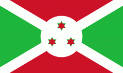
| Flag of Burundi | |
The Twa, Hutu and Tutsi peoples have lived in Burundi for at least 500 years. For more than 200 of those years, Burundi was an independent kingdom, until the beginning of the 20th century, when it became a German colony. After the First World War and Germany's defeat, the League of Nations "mandated" the territory to Belgium. After the Second World War, this transformed into a United Nations Trust Territory. Both Germans and Belgians ruled Burundi and Rwanda as a European colony known as Ruanda-Urundi. Burundi and Rwanda had never been under common rule until the time of European colonization of Africa.
Currency / Language
| ISO | Currency | Symbol | Significant figures |
|---|---|---|---|
| BIF | Burundian franc | Fr | 0 |
| ISO | Language |
|---|---|
| FR | French language |
| RN | Rundi language |